|
|
|
|
NEW MAIN CHEMTRAILS Abstract Croatian Diary CRO Diary 1 Images CRO Diary 200 1 Bossier, LA E-mail |
KUKULJANOVO 11-23-2000
By: IZAKOVIC
UPDATED: 12-05-2000
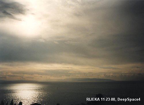
Look over the eastern Kvarner bay on 11-23-00 at 14:30. After two weeks long torrential rains (CLICK HERE) caused by the presence of USS SAIPAN (CLICK HERE), we see the first Sun rays going through thin cloud layer. It seems that there is delay in operation. Let's see what NOAA says.
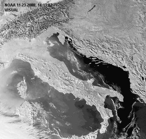
This
is visible spectrum. Kvarner bay with Rijeka City at his bottom is the top right
bay of Adriatic Sea, above the ITALIAN boot-shaped peninsula. Here is evident
why Croatian Adriatic coast is most beautiful in the whole World.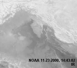
Remaining water vapor barely succeeds to stay airborne. As it have had rained it's guts out. Only visible chemtrail spraying going on is that above Balaton Lake in HUNGARY (note barely visible parallel chemtrail clouds over great inland lake on the top right).
The delay is of a global nature indeed.
On the right is northern Kvarner with Istrian peninsula shoot in the infra red spectrum. Note the presence of light cloud cover over the eastern part and at the bottom of the Kvarner bay. Clouds inland are more consistent.
When will they finally leave? (CLICK HERE)
Click
BACK button on the browser to return to the previous page.
Note: This file can be freely reproduced if the source is indicated. Note available at homepage of the site is integral part of this file.
All satellite images above marked NOAA are the courtesy of the National Oceanic & Atmospheric Administration (NOAA) whose main site is available by clicking here and the University of Strasbourg (France) with the site linked here.
file: rijeka2311001430500.htm